Geography - external forces 2

External forces: waves

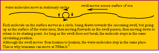
On the sea, the friction of wind on water produces ripples, then wavelets some of which break into white foam, and then waves. Big waves will keep travelling far beyond the wind which generated them. They are then called swells.
Wind blowing from the east is called an easterly wind. Swells going towards the east are called easterly swells.


As any surface water molecule moves in a stationary circle, it pushes against the molecule beneath so it too moves in a stationary circle beneath the surface molecule. There is a diminishing chain effect going downwards, such that, after a few meters, the effect peters out. Down there a diver will be unaware of the wave motion at the surface.

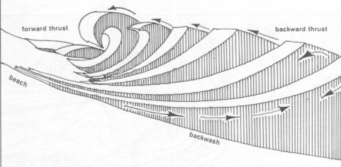
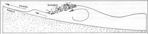
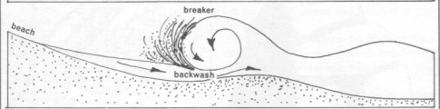
However, when the swell comes in towards a beach, the wave action touches the seabed in the shallows. Once the wave action touches the seabed, the wave becomes steeper and steeper, till the top of the wave breaks and collapses down its front. At the same time, the velocity and wavelength (distance between crests) of the swell diminishes.

 not found

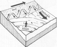
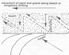
The rush of water up the beach is called the swash, and its retreat, the backwash.

 not found

 not found

 not found The swash can deposit sand and the backwash can remove it.
Rips

A rip can be quickly formed by several backwashes removing sand to form a shallow channel which tends to 'draw' water out. Two currents develop parallel to the beach, one from each direction, moving towards the channel then turning with the channel, scouring away sand and rushing seawards. As the channel quickly deepens, the rip accelerates.

Swimmers can be swept along the beach into the rip and out to sea. (There is lots of advice about how to escape rips, but having been caught, I do not believe any of it. I had 2 choices: to swim out through several rows of breakers and then parallel to the beach and back in, but the sea was rough and I am a weak swimmer, so for nearly an hour I patiently floated, breaststroking gently while being carried outwards, but catching the surf back in, till eventually I managed to touch ground and wade out. I was left so weak I was unable to walk for hours.)

Rips can usually be recognized because the waves do not usually break on a rip, leaving a clear channel out through the surf. Beware of undertow, that is, rips which drag you down along the seabed till long after you run out of air.

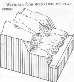
Wave platforms, cliffs

 not found

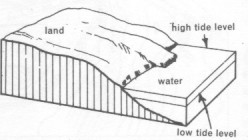
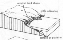
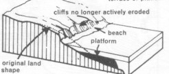
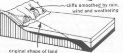
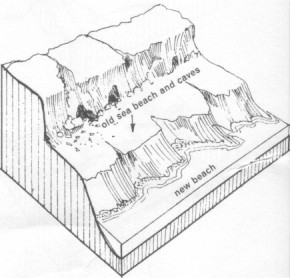
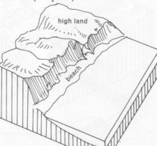
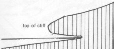
As sea level rises and falls, waves can cut platforms at different levels, undermining the hills to form cliffs.

These 4 diagrams show a sequence of beach erosions in which the dry land is undercut to form cliffs, while the eroded material becomes a platform. The platform may slow the waves sufficiently for sand to be deposited to form a beach under the cliffs.

 not found  not found  not found


 not found

Caves

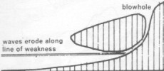
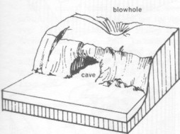
 not found Waves form caves by eroding, abrading, dissolving along lines of weakness, into a cliff, forming a tunnel. If the end of the tunnel collapses, a blowhole is formed.
 not found

 not found

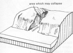
If the roof of the blowhole collapses, a ravine is formed.

 not found  not found

Headland swells

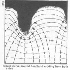
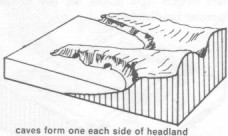
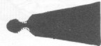
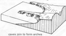
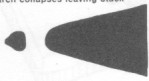
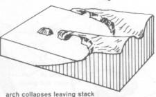
 not foundThe line of a swell bends around a headland (or the end of a solid stone jetty - like light through a diffraction grating). Thus waves can bend around a hard rock headland, attacking it from both sides. If the rock behind the head is softer, it will be undercut and collapse, forming an arch. If the arch collapses, the head will form a column in the sea, called a stack.


Stacks

The next 3 pairs of diagrams illustrate the sequence of forming stacks.
Looking down from aboveLooking seaward at an angle
 not found not found
 not found not found
 not found not found

Deposition

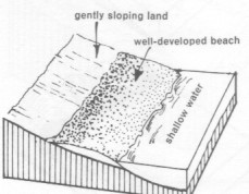
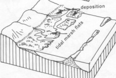
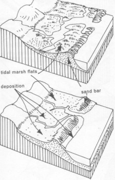
 not foundWhere the land slopes gently, a beach is usually well-developed because of the large expanse of shallow water, where the seabed slows the incoming waves, enabling the deposition of sediment carried by them.
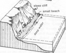


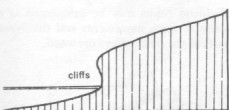
 not foundIn contrast, where the land rises steeply from the seabed, the wavs are less affected, deposition is small and undercutting is pronounced. The collapsed cliffs are stirred up in the waves and carried away.
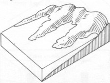
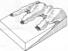
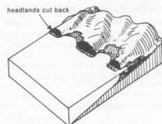
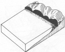
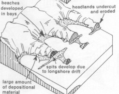
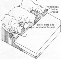
The next 4 diagrams show a sequence for headland and bay erosion.

Headlands

Headlands diffract the waves, and this, combined with decreasing depth, lessens their force. With less forceful waves there is less erosion and more deposition of sediment, so beaches form in the bays and coves between headlands.

 not found  not found

Thus the headlands bear the brunt of wave force while the bays are protected. This tends to straighten the coastline.

 not found not found

Groynes, spits, tombolos

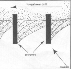
On straight unprotected beaches, the swells usually arrive obliquely (at an angle), causing the swash to move the sand along the beach. (Perth, Western Australia) Groynes, either rock or fences of wooden timbers driven into the sand, collect the sand and limit movement. The next season, when the waves come from the other direction, the sand is shifted backwards to the groyne below.

 not found  not found

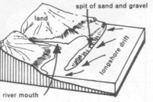
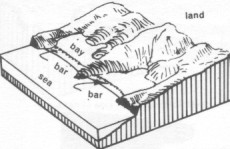
This same moving of sand along a beach can develop spits and bars across the mouths of creeks and rivers, inlets and ports. Spits begin at the beach and end in deep water, while bars go right across a river or bay from beach to beach or from headland to headland.

 not found  not found

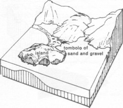
When a bar stretches from a headland to an island, it is called a tombolo. Sometimes 2 tombolos will form, one from each seasonal direction of waves, creating a swamp between them.

 not found  not found


External forces – shorelines

Shoreline influences

Shorelines are influenced by:

Coastal types

The types of coasts are:

Examples

Rhia coast

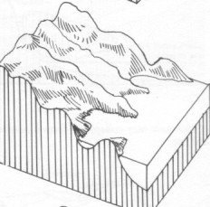
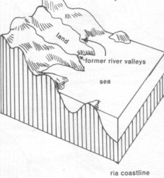
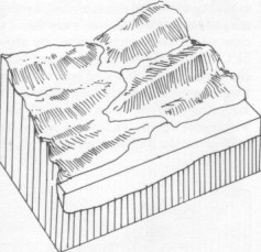
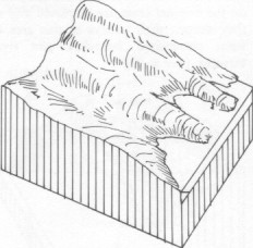
Rhia coasts are submerged highland areas where mountain ranges are perpendicular to the coast.
The next 3 diagrams show the evolution of the shoreline as either the land sinks or the ocean rises.
 not found  not found  not found

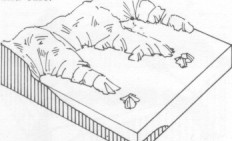
These next 3 diagrams show the erosion which can follow the submergence of a rhia coast.
 not found  not found  not found


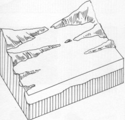
Longitudinal coasts are submerged highland areas where mountain ranges are parallel to the coast

 not found not found

Fiord coast

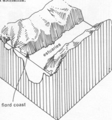
 not found Fiord coasts are coasts where glacial valleys are submerged.

Estuarine coast

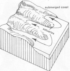
Estuary/estuarine coasts are coasts where lowland coasts are submerged, flooding river valleys
 not found  not found

Uplifted or emergent coast

 not found
Uplifted or emergent coasts are coasts where the coast has been raized and the ocean waves now erode a lower level.

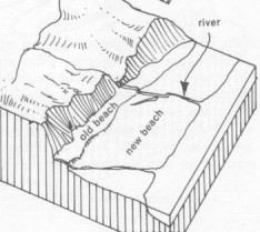
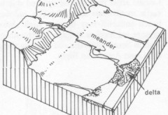
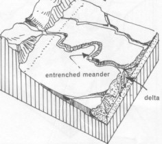
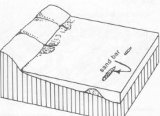
Here are 4 diagrams showing a sequence where a wide coastal plain has emerged. Rivers must carve channels across the plain whose gradual slope encourages the rivers to form sinuous channels. If you visit a beach with a river or creek across it, watch the tide come and go, to see how the slow river flow naturally meanders.

 not found not found
 not found not found

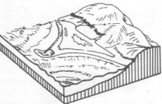
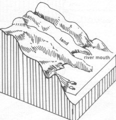
This sequence of 4, shows how the river lacks the flow needed to keep the mouth clear of sediment, so a spit forms and extends into a bar, blocking the flow and forming a lagoon. When the lagoon fills and overflows, the sudden rush of escaping water washes a gap through the bar.
 not found  not found  not found

Most Australian capital cities are built on submerged shorelines because they offer deep and protected harbours; while the emergent coasts, being shallow and even, rarely have suitable harbours.

External forces - coral
Coral polyps are tiny marine organisms which live in tube-like skeletons of calcium carbonate. The calcium chloride in seawater is extracted and converted with carbon dioxide to calcium carbonate.

As the polyps bud and divide, so the colony grows upwards and outwards, burying the older polyps which then die. Their skeletons feventually form a bed of hard but brittle calcium carbonate. If these are later covered with heavy sediments, the huge pressure can compress and convert them to hard limestone.

If the land then emerges, and weathering removes the upper layers, this limestone may be uncovered. Such limestone will then be weathered into cave-networked hills. Such hills are now found many kilometers from the sea.

Reef-building corals grow in tropical waters bounded by the 200C isotherm, although there are exceptions along Chile's coast, north of Japan and south of New Zealand and Australia.

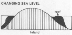
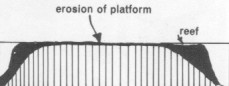
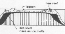
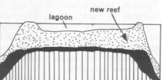
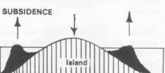
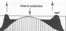
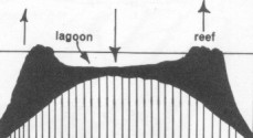
The polyps need strong sunlight, so grow near the surface. The existence of dead coral 100s of meters deep indicate the subsidence of land matched by the upward growing of coral to remain in strong sunlight..

Coral reef types

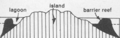
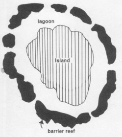
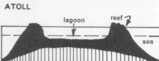
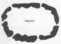
Coral reefs can be grouped as:

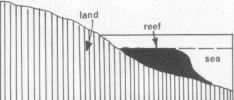
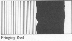
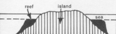
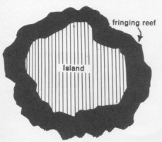
Fringe reef

 not found  not found
 not found not found

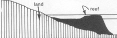
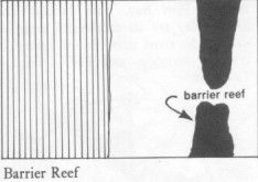
Barrier reef

The longest barrier reef, stretching 2000km along Queensland, Australia, although in shallow seas, consists of reefs within reefs, of variable distance from land. Runoff of fertilizer, other pollution and soil erosion from housing developments and farming, as well as the crown-of-thorns starfish, are destroying the reef. Oil companies want to drill for oil, so previous governments seem to have been encouraged to avoid protecting the reef.

 not found not found

 not found not found

Atoll reef

 not found not found

Rising sea-level

 not found; not found>
 not found not found

Land subsidence

 not found  not found  not found

Content by Carolyn R Stone; diagrams by Derrick I Stone